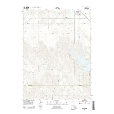
2014 Map of North Loup
USGS Topo · Published 2014About this map
North Loup anchors the northern portion of this landscape where the Mira Cr and its branches converge. The village grid is defined by historical corridors like W Central Ave and W Lincoln Ave, situated just north of the Hillside Cem. Water management is a defining characteristic of this central Nebraska terrain, evidenced by the extensive Ord-North Loup Canal and the sprawling Davis Creek Reservoir to the southeast. To the west, the topography grows more complex near Englehoff Canyon, while the southern reaches near the Valley and Sherman County line feature the Hickman Reservoir Number 1. This 2014 survey documents a region where agricultural irrigation infrastructure and natural drainage systems like Davis Cr dictate the layout of the local road network.
Find a feature on this map
33 named features on this map. Tap any name to fly to it.
Don’t see what you’re looking for? This feature index may not catch every label — zoom into the map to look around manually.
Map Details
Editions of this 2014 North Loup Map
This is the sole edition of this map. No revisions or reprints were ever made.
Other maps of this area

1899 · Loup
USGS Topo · 1:125,000

1953 · Loup City NW
USGS Topo · 1:24,000

1953 · Cotesfield
USGS Topo · 1:24,000

1953 · North Loup
USGS Topo · 1:24,000

1953 · Scotia
USGS Topo · 1:24,000

1953 · Loup City SE
USGS Topo · 1:24,000

1953 · Loup City
USGS Topo · 1:24,000

1954 · Ord SE
USGS Topo · 1:24,000

1954 · Ord
USGS Topo · 1:24,000

1954 · Horace
USGS Topo · 1:24,000