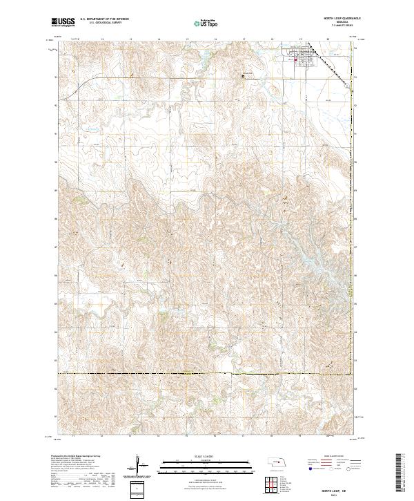
2021 Map of North Loup
USGS Topo · Published 2021About this map
North Loup anchors the northern edge of this Nebraska landscape, where the grid of the town site meets the winding path of Mira Cr. The terrain is defined by the sharp, dissected uplands typical of the region, dropping toward the expansive Davis Creek Reservoir in the southeast. Historical infrastructure like the Old North Loup Canal traces the path of early water management across the prairie. The map shows the transition from Valley County into Sherman County to the south and Greeley County to the east, capturing a network of rural routes such as Ashton Hwy and the numbered roads that serve the surrounding agricultural sections. For genealogists, the Hillside Cem north of town provides a specific point of interest for local family research in this well-documented portion of the Nebraska loess hills.
Find a feature on this map
43 named features on this map. Tap any name to fly to it.
Don’t see what you’re looking for? This feature index may not catch every label — zoom into the map to look around manually.
Map Details
Editions of this 2021 North Loup Map
This is the sole edition of this map. No revisions or reprints were ever made.
Other maps of this area

1899 · Loup
USGS Topo · 1:125,000

1953 · Loup City NW
USGS Topo · 1:24,000

1953 · Cotesfield
USGS Topo · 1:24,000

1953 · North Loup
USGS Topo · 1:24,000

1953 · Scotia
USGS Topo · 1:24,000

1953 · Loup City SE
USGS Topo · 1:24,000

1953 · Loup City
USGS Topo · 1:24,000

1954 · Ord SE
USGS Topo · 1:24,000

1954 · Ord
USGS Topo · 1:24,000

1954 · Horace
USGS Topo · 1:24,000