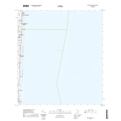
2021 Map of North Miami OE E
USGS Topo · Published 2021About this map
Sunny Isles Beach and the barrier island communities of Southeast Florida are presented here at the transition between the 2010s and 2020s. This coastal survey tracks the intense development along the narrow strip between the Atlantic Ocean and the Intracoastal Waterway. The geography is defined by artificial landforms and luxury enclaves like North Island, Central Island, and South Island, alongside the recreational corridor of Haulover Beach. The map details the precise engineering of the coastline, from the Bakers Haulover Inlet up through the established boundaries of Hollywood and Hallandale Beach. Urban infrastructure, including Collins Ave and the Snake Creek Trl, illustrates the modern connectivity of this high-density waterfront region, where natural shoreline has been replaced by a sophisticated network of canals and dredged inlets like Golden Isles Lake.
Find a feature on this map
32 named features on this map. Tap any name to fly to it.
Don’t see what you’re looking for? This feature index may not catch every label — zoom into the map to look around manually.
Map Details
Editions of this 2021 North Miami OE E Map
This is the sole edition of this map. No revisions or reprints were ever made.
Other maps of this area

1947 · North Miami
USGS Topo · 1:24,000

1949 · Port Everglades
USGS Topo · 1:24,000

1949 · Fort Lauderdale South
USGS Topo · 1:24,000

1950 · Miami
USGS Topo · 1:24,000

1950 · North Miami
USGS Topo · 1:24,000

1956 · Miami
USGS Topo · 1:250,000

1956 · West Palm Beach
USGS Topo · 1:250,000

1957 · West Palm Beach
USGS Topo · 1:250,000

1958 · West Palm Beach
USGS Topo · 1:250,000

1958 · Miami
USGS Topo · 1:250,000