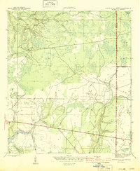
1945 Map of North Of Allanton
USGS Topo · Published 1945About this map
Bayou George and its tributaries define the northwestern portion of this Florida Panhandle landscape, where the Majette Fire Tower once stood as a lonely sentinel over the surrounding timberlands. Surveyed during the final years of the Second World War, the map reveals a largely uninhabited interior characterized by dense drainage networks and low-lying wetlands like California Swamp and Green Bay Swamp. The presence of the Kent Cem near the confluence of Big Branch and Water Branch provides a vital point of reference for genealogists tracking early families in this part of Bay County.
Find a feature on this map
21 named features on this map. Tap any name to fly to it.
Don’t see what you’re looking for? This feature index may not catch every label — zoom into the map to look around manually.
Map Details
Editions of this 1945 North Of Allanton Map
3 editions found
Other maps of this area

1944 · Long Point
USGS Topo · 1:31,680

1944 · Bayhead
USGS Topo · 1:24,000

1945 · Youngstown
USGS Topo · 1:31,680

1945 · Bayhead
USGS Topo · 1:31,680

1945 · Broad Branch
USGS Topo · 1:31,680

1945 · Allanton
USGS Topo · 1:31,680

1945 · North Of Allanton
USGS Topo · 1:31,680

1945 · Wetappo Creek
USGS Topo · 1:31,680

1945 · Tenmile Swamp
USGS Topo · 1:31,680
1945 · Parker
USGS Topo · 1:31,680