
1945 Map of North Of Allanton
USGS Topo · Published 1945About this map
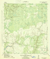
Bayou George and a complex network of wetlands dominate this 1940s landscape, surveyed during the final years of World War II. The terrain is defined by a dense intersection of water and timberland, where Sandy Creek and Olivers Creek drain into the tidal reaches of the bayou system. Human presence is sparse but strategically placed, centered on the Allanton Road corridor. The Majette Fire Tower stands as a primary landmark for forest management, overlooking vast tracts like California Swamp and Green Bay Swamp. Genealogists will find the Kent Cem located near Big Branch, a small burial ground preserved in the backcountry. The map reveals the precise boundaries between Bay, Calhoun, and Gulf Counties, showing how these political lines were drawn through the heart of the Tenmile Swamp and along remote watercourses like Mule Cr.
Find a feature on this map
20 named features on this map. Tap any name to fly to it.
Don’t see what you’re looking for? This feature index may not catch every label — zoom into the map to look around manually.
Map Details
Editions of this 1945 North Of Allanton Map
3 editions found
Other maps of this area

1944 · Long Point
USGS Topo · 1:31,680

1944 · Bayhead
USGS Topo · 1:24,000

1945 · Youngstown
USGS Topo · 1:31,680

1945 · Bayhead
USGS Topo · 1:31,680

1945 · Broad Branch
USGS Topo · 1:31,680

1945 · Allanton
USGS Topo · 1:31,680

1945 · Wetappo Creek
USGS Topo · 1:31,680

1945 · Tenmile Swamp
USGS Topo · 1:31,680
1945 · Parker
USGS Topo · 1:31,680

1947 · Allanton
USGS Topo · 1:25,000