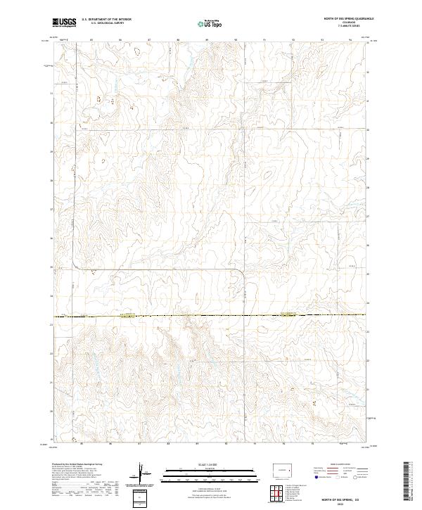
2022 Map of North of Big Spring
USGS Topo · Published 2022About this map
N Fork Smoky Hill River flows through the southeastern corner of this High Plains landscape, where the boundary between Kit Carson Co and Cheyenne Co is defined by a perfectly straight survey line. The area is characterized by an extensive network of ephemeral drainage systems including Landsman Cr, Little Spring Cr, and the various branches of Big Spring Creek. These waterways carve subtle relief into the terrain, creating the distinct valleys of E Fork Big Spring Cr and Middle Fork Big Spring Cr. A rigid grid of rural infrastructure connects the ranchlands, with local routes like Co RD 20 and Co RD F providing access across the township and range sections. The map illustrates the transition from the upper reaches of E Br Spring Cr in the north to the more prominent river basin in the south.
Find a feature on this map
25 named features on this map. Tap any name to fly to it.
Don’t see what you’re looking for? This feature index may not catch every label — zoom into the map to look around manually.
Map Details
Editions of this 2022 North of Big Spring Map
This is the sole edition of this map. No revisions or reprints were ever made.
Other maps of this area

1891 · Kit Carson
USGS Topo · 1:125,000

1893 · Kit Carson
USGS Topo · 1:125,000

1954 · Limon
USGS Topo · 1:250,000

1954 · Lamar
USGS Topo · 1:250,000

1957 · Limon
USGS Topo · 1:250,000

1958 · Limon
USGS Topo · 1:250,000

1958 · Lamar
USGS Topo · 1:250,000

1979 · Stratton 3 SE
USGS Topo · 1:24,000
1979 · Alpine Ranch NW
USGS Topo · 1:24,000
1979 · Stratton 3 SW
USGS Topo · 1:24,000