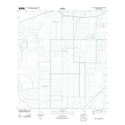
2012 Map of North of Bluefield
USGS Topo · Published 2012About this map
Agricultural field patterns and citrus groves define this section of Saint Lucie County in the early 21st century. The landscape is heavily engineered, dominated by a geometric grid of drainage features including the Germany Canal RD and C-24 Canal RD. These canals and their accompanying access roads facilitate the region's intense citrus production, characteristic of the Florida interior.
Find a feature on this map
17 named features on this map. Tap any name to fly to it.
Don’t see what you’re looking for? This feature index may not catch every label — zoom into the map to look around manually.
Map Details
Editions of this 2012 North of Bluefield Map
This is the sole edition of this map. No revisions or reprints were ever made.
Other maps of this area

1949 · Fort Pierce NW
USGS Topo · 1:24,000

1950 · Fort Pierce NW
USGS Topo · 1:24,000

1953 · Okeechobee 1 SE
USGS Topo · 1:24,000

1953 · Okeechobee 4 NE
USGS Topo · 1:24,000

1953 · Okeechobee 4 NW
USGS Topo · 1:24,000

1953 · Okeechobee 1 SW
USGS Topo · 1:24,000

1953 · Indian Town NW
USGS Topo · 1:24,000

1953 · Okeechobee 1 NE
USGS Topo · 1:24,000

1953 · Okeechobee 1 NW
USGS Topo · 1:24,000

1953 · Fort Pierce SW
USGS Topo · 1:24,000