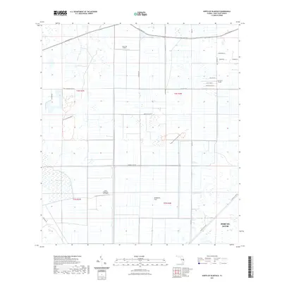
2021 Map of North of Bluefield
USGS Topo · Published 2021About this map
Allapattah Flats dominates this portion of Saint Lucie County, illustrating a landscape defined by water management and aviation. The grid-like agricultural and conservation areas are bisected by significant water features such as Rim Ditch and the Germany Canal Rd. Several private landing strips, including Hales 700 Airport and Aero Acres Airport, reflect the region's historical and ongoing reliance on light aircraft for commerce and access across the marshy terrain.
Find a feature on this map
29 named features on this map. Tap any name to fly to it.
Don’t see what you’re looking for? This feature index may not catch every label — zoom into the map to look around manually.
Map Details
Editions of this 2021 North of Bluefield Map
This is the sole edition of this map. No revisions or reprints were ever made.
Other maps of this area

1949 · Fort Pierce NW
USGS Topo · 1:24,000

1950 · Fort Pierce NW
USGS Topo · 1:24,000

1953 · Okeechobee 1 SE
USGS Topo · 1:24,000

1953 · Okeechobee 4 NE
USGS Topo · 1:24,000

1953 · Okeechobee 4 NW
USGS Topo · 1:24,000

1953 · Okeechobee 1 SW
USGS Topo · 1:24,000

1953 · Indian Town NW
USGS Topo · 1:24,000

1953 · Okeechobee 1 NE
USGS Topo · 1:24,000

1953 · Okeechobee 1 NW
USGS Topo · 1:24,000

1953 · Fort Pierce SW
USGS Topo · 1:24,000