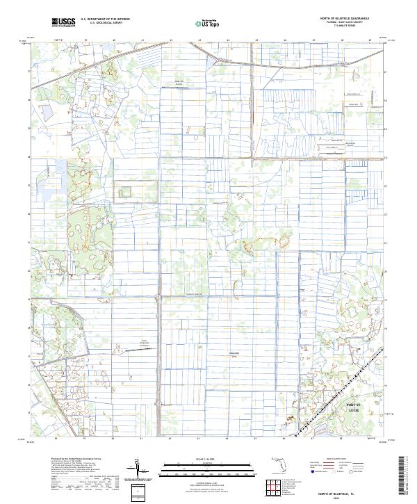
2024 Map of North of Bluefield
USGS Topo · Published 2024About this map
Allapattah Flats dominates the landscape of Saint Lucie County in this recent survey, showing a complex network of agricultural drainage and aviation infrastructure. The region is characterized by a grid of citrus groves and agricultural tracts, served by specialized landing strips including Evans Properties Inc Airport, Hales 700 Airport, and the Aero Acres Airport. Water management is central to the land's utility, with the Rim Ditch and Germany Canal Rd cutting through the terrain to regulate the wetlands and flatlands. Along the western edge, the Saint Lucie Pinelands Trl offers a different perspective on the native landscape near Cypress Creek. To the southeast, the map captures the western fringes of Port St. Lucie, where the agricultural grid meets the encroaching development of the coastal plain, connected by major thoroughfares like Okeechobee Rd and Glades Cut Off Rd.
Find a feature on this map
31 named features on this map. Tap any name to fly to it.
Don’t see what you’re looking for? This feature index may not catch every label — zoom into the map to look around manually.
Map Details
Editions of this 2024 North of Bluefield Map
This is the sole edition of this map. No revisions or reprints were ever made.
Other maps of this area

1949 · Fort Pierce NW
USGS Topo · 1:24,000

1950 · Fort Pierce NW
USGS Topo · 1:24,000

1953 · Okeechobee 1 SE
USGS Topo · 1:24,000

1953 · Okeechobee 4 NE
USGS Topo · 1:24,000

1953 · Okeechobee 4 NW
USGS Topo · 1:24,000

1953 · Okeechobee 1 SW
USGS Topo · 1:24,000

1953 · Indian Town NW
USGS Topo · 1:24,000

1953 · Okeechobee 1 NE
USGS Topo · 1:24,000

1953 · Okeechobee 1 NW
USGS Topo · 1:24,000

1953 · Fort Pierce SW
USGS Topo · 1:24,000