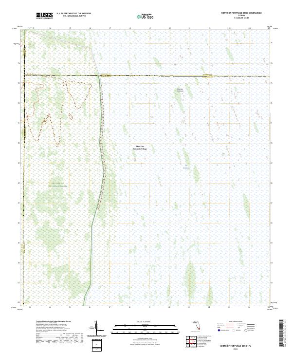
2024 Map of North of Fortymile Bend
USGS Topo · Published 2024About this map
Mart Law Seminole Village stands as a central cultural landmark within this specific portion of The Everglades, situated at the intersection of three major Florida counties. The landscape is dominated by the sprawling conservation efforts of the Big Cypress National Preserve, where the watery expanse is punctuated by elevated terrain features such as Choctaw Hammock. The mapping of this region illustrates the complex jurisdictional boundaries where Collier, Broward, and Miami-Dade counties meet. Transportation is nearly non-existent in this wetland environment, save for the single track of the Jet Port Trl cutting through the western section. This survey emphasizes the preservation of the delicate Florida ecosystem, capturing the state of these protected lands and indigenous settlements in the early 21st century.
Find a feature on this map
14 named features on this map. Tap any name to fly to it.
Don’t see what you’re looking for? This feature index may not catch every label — zoom into the map to look around manually.
Map Details
Editions of this 2024 North of Fortymile Bend Map
This is the sole edition of this map. No revisions or reprints were ever made.
Other maps of this area

1956 · Miami
USGS Topo · 1:250,000

1956 · West Palm Beach
USGS Topo · 1:250,000

1957 · West Palm Beach
USGS Topo · 1:250,000

1958 · West Palm Beach
USGS Topo · 1:250,000

1958 · Miami
USGS Topo · 1:250,000

1973 · Fortymile Bend
USGS Topo · 1:24,000

1973 · Custard Apple Hammock
USGS Topo · 1:24,000

1973 · Fiftymile Bend
USGS Topo · 1:24,000

1973 · North Of Fiftymile Bend
USGS Topo · 1:24,000

1973 · Long Island
USGS Topo · 1:24,000