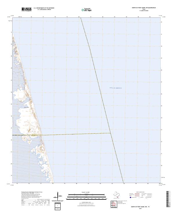
2025 Map of North of Port Isabel NW
USGS Topo · Published 2025About this map
Padre Island dominates the western edge of this coastal survey, where the shifting sands of the barrier island meet the expanse of the Gulf of America. The landscape is defined by the dynamic interface of salt water and coastal dunes, illustrating the fragile geography of the Texas shoreline. A notable administrative boundary bisects the island, marking the transition between Willacy Co and Cameron Co. This segment of the coast remains largely undeveloped, providing a clear record of the natural topography and shoreline configuration at the time of the survey. The map serves as a precise baseline for understanding the environmental changes and coastal migration patterns in this specific reach of the Gulf Coast.
Find a feature on this map
3 named features on this map. Tap any name to fly to it.
Don’t see what you’re looking for? This feature index may not catch every label — zoom into the map to look around manually.
Map Details
Editions of this 2025 North of Port Isabel NW Map
This is the sole edition of this map. No revisions or reprints were ever made.
Other maps of this area

1929 · Buena Vista
USGS Topo · 1:24,000

1930 · Padre Island No. 2
USGS Topo · 1:24,000

1935 · Padre Island NO. 2
USGS Topo · 1:31,680

1935 · Buena Vista
USGS Topo · 1:31,680

1952 · Green Island
USGS Topo · 1:24,000
1952 · North Of Port Isabel NW
USGS Topo · 1:24,000

1952 · South of Potrero Lopeno SE
USGS Topo · 1:24,000

1952 · South of Potrero Lopeno
USGS Topo · 1:62,500

1953 · Brownsville
USGS Topo · 1:250,000
1954 · Three Islands
USGS Topo · 1:24,000