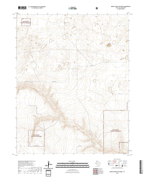
2022 Map of North of Red Cow Draw
USGS Topo · Published 2022About this map
Rita Blanca National Grassland segments define the character of this Dallam County landscape, showing the protected open spaces of the Texas Panhandle. The topography is marked by the drainages leading toward the Red Cow Draw, with a network of rural roads providing access to remote ranching parcels. Named routes such as Ben Tom Rd and Minnie Mack Ln crisscross the northern sections, while Lost Camp Rd skirts the southern draws. This 2022 survey, incorporating data from the U.S. Forest Service, highlights the modern distribution of public and private lands in a region where large-scale cattle grazing and conservation efforts coexist. The map traces the precise boundaries of the national grassland across the undulating plains, offering a clear view of the area's current land use and road network.
Find a feature on this map
7 named features on this map. Tap any name to fly to it.
Don’t see what you’re looking for? This feature index may not catch every label — zoom into the map to look around manually.
Map Details
Editions of this 2022 North of Red Cow Draw Map
This is the sole edition of this map. No revisions or reprints were ever made.
Other maps of this area

1954 · Dalhart
USGS Topo · 1:250,000

1958 · Dalhart
USGS Topo · 1:250,000

1962 · Dalhart
USGS Topo · 1:250,000

1964 · Stratford 2 SE
USGS Topo · 1:24,000

1964 · Stratford 2 NE
USGS Topo · 1:24,000

1969 · Boise City SE
USGS Topo · 1:24,000

1971 · Conrad SW
USGS Topo · 1:24,000
1971 · Conrad
USGS Topo · 1:24,000

1973 · Stratford 2 NW
USGS Topo · 1:24,000

1973 · Coldwater East
USGS Topo · 1:24,000