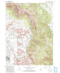
1992 Map of North Ogden
USGS Topo · Published 1992About this map
North Ogden and Pleasant View sit at the foot of the Wasatch Range in this 1992 revision, showing a landscape defined by its transition from suburban blocks to high mountain peaks. The map details a dense concentration of local institutions, including the Ogden-Weber Area Vocational Center, the State Hosp, and several neighborhood schools like Lincoln Sch and McGriff Sch. Of particular interest to local historians is the Ben Lomond Cemetery and the presence of the Ft Carson Army Res Ctr and Defense Depot Ogden, reflecting the area's mid-century military and civic growth.
Find a feature on this map
67 named features on this map. Tap any name to fly to it.
Don’t see what you’re looking for? This feature index may not catch every label — zoom into the map to look around manually.
Map Details
Editions of this 1992 North Ogden Map
2 editions found
Other maps of this area

1954 · Ogden
USGS Topo · 1:250,000

1954 · Brigham City
USGS Topo · 1:250,000

1955 · Ogden
USGS Topo · 1:24,000

1955 · Plain City
USGS Topo · 1:24,000

1955 · Roy
USGS Topo · 1:24,000

1955 · Mantua
USGS Topo · 1:24,000

1955 · Huntsville
USGS Topo · 1:24,000

1955 · James Peak
USGS Topo · 1:24,000

1955 · Willard
USGS Topo · 1:24,000

1955 · North Ogden
USGS Topo · 1:24,000