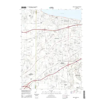
2016 Map of North Olmsted
USGS Topo · Published 2016About this map
Lake Erie defines the northern reaches of this suburban landscape, where the communities of Bay Village and Avon Lake meet at the Lorain and Cuyahoga county line. The map illustrates a dense network of residential growth established along historical corridors like Detroit Rd and Center Ridge Rd. Significant local history is preserved in numerous burial grounds, including the Saint Paul Lutheran Cem and the expansive Sunset Memorial Park Cem.
Find a feature on this map
45 named features on this map. Tap any name to fly to it.
Don’t see what you’re looking for? This feature index may not catch every label — zoom into the map to look around manually.
Map Details
Editions of this 2016 North Olmsted Map
This is the sole edition of this map. No revisions or reprints were ever made.
Other maps of this area

1901 · Oberlin
USGS Topo · 1:62,500

1902 · Berea
USGS Topo · 1:62,500

1903 · Oberlin
USGS Topo · 1:62,500

1904 · Berea
USGS Topo · 1:62,500

1950 · Cleveland
USGS Topo · 1:250,000

1953 · West View
USGS Topo · 1:24,000

1953 · Berea
USGS Topo · 1:24,000

1953 · Grafton
USGS Topo · 1:24,000

1953 · Avon
USGS Topo · 1:24,000
1953 · Lakewood
USGS Topo · 1:24,000