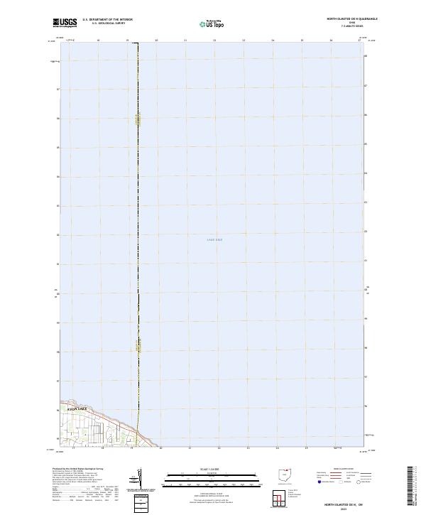
2023 Map of North Olmsted OE N
USGS Topo · Published 2023About this map
Lake Erie dominates this coastal perspective, where the shoreline of Northern Ohio meets the expanse of the Great Lakes. The map focuses on the waterside portion of Avon Lake, showing the developed residential blocks and streets that front the lake. The interface between Lorain Co and Cuyahoga Co is clearly demarcated, marking a significant administrative boundary that runs north into the water. This modern survey provides a detailed look at the contemporary coastal layout, where the lake serves as the primary geographic feature and the surrounding community of Avon Lake clusters along the water's edge. The focus on the shoreline allows for a clear visualization of the local street network as it terminates near the beach and residential properties.
Find a feature on this map
3 named features on this map. Tap any name to fly to it.
Don’t see what you’re looking for? This feature index may not catch every label — zoom into the map to look around manually.
Map Details
Editions of this 2023 North Olmsted OE N Map
This is the sole edition of this map. No revisions or reprints were ever made.
Other maps of this area

1901 · Oberlin
USGS Topo · 1:62,500

1902 · Berea
USGS Topo · 1:62,500

1903 · Oberlin
USGS Topo · 1:62,500

1904 · Berea
USGS Topo · 1:62,500

1950 · Cleveland
USGS Topo · 1:250,000

1953 · Avon
USGS Topo · 1:24,000
1953 · Lakewood
USGS Topo · 1:24,000
1953 · North Olmsted
USGS Topo · 1:24,000

1956 · Cleveland
USGS Topo · 1:250,000

1956 · Toledo
USGS Topo · 1:250,000