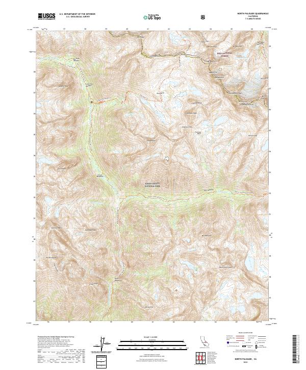
2021 Map of North Palisade
USGS Topo · Published 2021About this map
Kings Canyon National Park and the Inyo National Forest meet along the dramatic crest of the Sierra Nevada, where the boundary between Fresno and Inyo counties follows the high peaks. The landscape is defined by the headwaters of the Middle Fork Kings River, which carves through Le Conte Canyon past Big Pete Meadow and Little Pete Meadow. To the east, the terrain rises sharply to a series of formidable summits, including the namesake North Palisade, Thunderbolt Peak, and Mt. Winchell. Movement through this high-altitude wilderness is dictated by established routes like the Pacific Crest National Scenic Trl and the Bishop Pass Trl, which navigate steep elevations via the Dusy Switchbacks Trl to reach Bishop Pass. Glacial features such as the Palisade Basin and Barrett Lakes highlight the transition from deep river valleys to the granite spires of the High Sierra.
Find a feature on this map
67 named features on this map. Tap any name to fly to it.
Don’t see what you’re looking for? This feature index may not catch every label — zoom into the map to look around manually.
Map Details
Editions of this 2021 North Palisade Map
This is the sole edition of this map. No revisions or reprints were ever made.
Other maps of this area

1903 · Tehipite
USGS Topo · 1:125,000

1905 · Tehipite
USGS Topo · 1:125,000

1907 · Mt. Whitney
USGS Topo · 1:125,000

1912 · Mt. Goddard
USGS Topo · 1:125,000

1913 · Bishop
USGS Topo · 1:125,000

1919 · Mt. Whitney
USGS Topo · 1:125,000

1937 · Mt. Whitney
USGS Topo · 1:125,000

1947 · Mariposa
USGS Topo · 1:250,000

1948 · Fresno
USGS Topo · 1:250,000

1948 · Mariposa
USGS Topo · 1:250,000