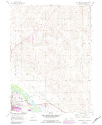
1970 Map of North Platte East
USGS Topo · Published 1983About this map
The North Platte River flows through the southern portion of this landscape, serving as a focal point for the region's transport and utility infrastructure in the early 1970s. Parallel to the river, the Union Pacific railroad corridor anchors the local economy, supported by industrial sites like the Gravel Pit and the aviation hub at Lee Bird Field. Settlement is concentrated on the southern bank, where a Trailer Park and Memorial Park are situated near the city's expanding urban boundary.
Find a feature on this map
15 named features on this map. Tap any name to fly to it.
Don’t see what you’re looking for? This feature index may not catch every label — zoom into the map to look around manually.
Map Details
Editions of this 1970 North Platte East Map
2 editions found
Other maps of this area

1899 · North Platte
USGS Topo · 1:125,000

1902 · North Platte
USGS Topo · 1:125,000

1954 · North Platte
USGS Topo · 1:250,000

1956 · North Platte
USGS Topo · 1:250,000

1957 · North Platte
USGS Topo · 1:250,000

1967 · North Platte
USGS Topo · 1:250,000

1970 · North Platte East
USGS Topo · 1:24,000

1970 · North Platte West
USGS Topo · 1:24,000
1970 · Maxwell
USGS Topo · 1:24,000
1970 · Maxwell SW
USGS Topo · 1:24,000