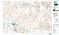
1985 Map of North Platte
USGS Topo · Published 1994About this map
North Platte serves as the focal point of this mid-1980s Nebraska landscape, where the confluence of the North Platte River and South Platte River dictates the region's transport and irrigation patterns. The Union Pacific railroad and Interstate 80 corridor track the river valleys, connecting smaller rail-towns like Hershey, Maxwell, and Brady. To the south of the river, Lake Maloney and the Tri-County Supply Canal represent the extensive water management infrastructure vital to the agricultural economy of the high plains.
Find a feature on this map
64 named features on this map. Tap any name to fly to it.
Don’t see what you’re looking for? This feature index may not catch every label — zoom into the map to look around manually.
Map Details
Editions of this 1985 North Platte Map
2 editions found
Other maps of this area

1896 · Lexington
USGS Topo · 1:125,000

1898 · Paxton
USGS Topo · 1:125,000

1899 · Lexington
USGS Topo · 1:125,000

1899 · North Platte
USGS Topo · 1:125,000

1901 · Paxton
USGS Topo · 1:125,000

1902 · Gothenburg
USGS Topo · 1:125,000

1902 · North Platte
USGS Topo · 1:125,000

1948 · Linscott
USGS Topo · 1:62,500

1949 · Cody Lake
USGS Topo · 1:62,500

1949 · Wright Valley
USGS Topo · 1:62,500