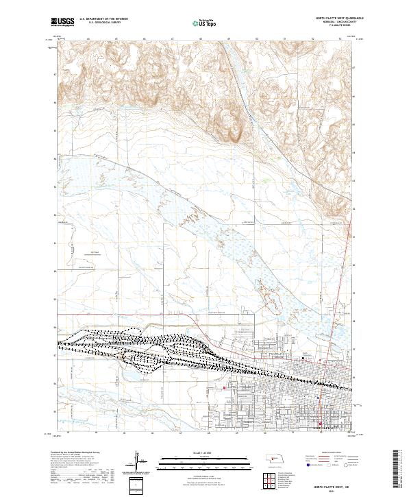
2021 Map of North Platte West
USGS Topo · Published 2021About this map
The city of North Platte sits at the confluence of two major prairie waterways, dominated by the extensive rail yards and industrial corridors that define the town's geography. This modern survey illustrates the complex water management systems of the region, where the Birdwood Canal, North Platte Canal, and South Platte River provide the vital irrigation required for the surrounding Nebraska agricultural landscape. The map captures a high level of detail within the urban center, including the Lincoln County Courthouse and the sprawling rail network running parallel to West Front Street. On the western edge of the city, the legacy of the Old West is visible in road names such as Scouts Rest Ranch Road, while the north features landmarks like Hansen Reservoir and Lamplaugh Lake. Local history is further preserved through named sites such as the North Platte Cemetery and Orr Field.
Find a feature on this map
90 named features on this map. Tap any name to fly to it.
Don’t see what you’re looking for? This feature index may not catch every label — zoom into the map to look around manually.
Map Details
Editions of this 2021 North Platte West Map
This is the sole edition of this map. No revisions or reprints were ever made.
Other maps of this area

1899 · North Platte
USGS Topo · 1:125,000

1902 · North Platte
USGS Topo · 1:125,000

1954 · North Platte
USGS Topo · 1:250,000

1956 · North Platte
USGS Topo · 1:250,000

1957 · North Platte
USGS Topo · 1:250,000

1967 · North Platte
USGS Topo · 1:250,000

1970 · North Platte East
USGS Topo · 1:24,000

1970 · North Platte West
USGS Topo · 1:24,000
1970 · North Platte SW
USGS Topo · 1:24,000
1970 · Hershey East
USGS Topo · 1:24,000
Featured Places
- North Platte, NE
- Green Acres Trailer Court, NE
- Key Estates, North Platte
- Mobile Manor, North Platte
- Village Square, North Platte