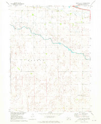
1970 Map of North Platte SW
USGS Topo · Published 1973About this map
Fremont Slough and the winding course of the Outlet Canal define the hydrology of this Lincoln County landscape during the early 1970s. This survey, conducted as part of the Department of the Interior program for the development of the Missouri River Basin, shows a rural expanse organized by large sections and terrain divisions named Nowell, Miller, and Sellers. The presence of Trinity Ch provides a central landmark for local genealogy, marking a gathering point for the surrounding farmsteads.
Find a feature on this map
11 named features on this map. Tap any name to fly to it.
Don’t see what you’re looking for? This feature index may not catch every label — zoom into the map to look around manually.
Map Details
Editions of this 1970 North Platte SW Map
This is the sole edition of this map. No revisions or reprints were ever made.
Other maps of this area

1898 · Paxton
USGS Topo · 1:125,000

1899 · North Platte
USGS Topo · 1:125,000

1901 · Paxton
USGS Topo · 1:125,000

1902 · North Platte
USGS Topo · 1:125,000

1954 · McCook
USGS Topo · 1:250,000

1954 · North Platte
USGS Topo · 1:250,000

1956 · North Platte
USGS Topo · 1:250,000

1957 · North Platte
USGS Topo · 1:250,000

1957 · McCook
USGS Topo · 1:250,000

1958 · McCook
USGS Topo · 1:250,000