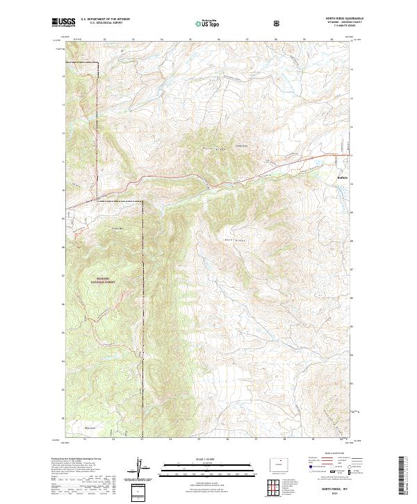
2021 Map of North Ridge
USGS Topo · Published 2021About this map
Bighorn National Forest dominates the southwestern portion of this map, characterized by a complex network of ridgelines and water-diversion infrastructure. Significant topographical features like North Ridge, Bald Ridge, and Grouse Mtn define the high country, while the eastern edge of the survey transitions toward the outskirts of Buffalo. The landscape is heavily marked by early and modern water management, including the Moeller Ditch Number 1, Johnson County Ditch, and Eagle Ditch, illustrating the area's reliance on mountain runoff for valley irrigation.
Find a feature on this map
47 named features on this map. Tap any name to fly to it.
Don’t see what you’re looking for? This feature index may not catch every label — zoom into the map to look around manually.
Map Details
Editions of this 2021 North Ridge Map
This is the sole edition of this map. No revisions or reprints were ever made.
Other maps of this area

1900 · Fort McKinney
USGS Topo · 1:125,000

1903 · Fort McKinney
USGS Topo · 1:125,000

1955 · Sheridan
USGS Topo · 1:250,000

1958 · Sheridan
USGS Topo · 1:250,000

1962 · Sheridan
USGS Topo · 1:250,000

1967 · Lake De Smet West
USGS Topo · 1:24,000

1967 · Caribou Creek
USGS Topo · 1:24,000
1967 · Klondike Ranch
USGS Topo · 1:24,000
1967 · Hunter Mesa
USGS Topo · 1:24,000
1967 · Stone Mountain
USGS Topo · 1:24,000