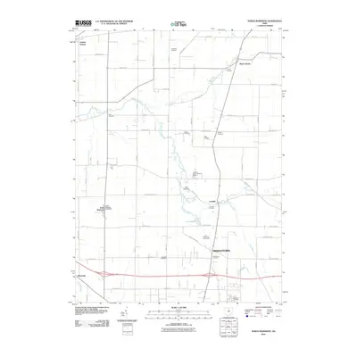
2010 Map of North Robinson
USGS Topo · Published 2010About this map
North Robinson and the surrounding Crawford County townships sit at a distinctive crossroads of rural Ohio history, where the headwaters of the Sandusky River and Loss Creek carve through the agricultural landscape. The village of Leesville remains a central point of interest, situated near the Leesville Cemetery and the waters of Lake Galion. The area is characterized by numerous family and community landmarks, including Liberty Cemetery, Luke Cemetery, and Biddle Cemetery, which offer valuable points of reference for genealogists tracing the legacy of early settlers in settlements like Sulphur Springs and Middletown. Historical transport corridors like the Lincoln Hwy and local infrastructure such as the North Robinson Post Office and Cole Airfield illustrate the intersection of local commerce and early aviation in this part of the state.
Find a feature on this map
47 named features on this map. Tap any name to fly to it.
Don’t see what you’re looking for? This feature index may not catch every label — zoom into the map to look around manually.
Map Details
Editions of this 2010 North Robinson Map
This is the sole edition of this map. No revisions or reprints were ever made.
Other maps of this area

1913 · Mount Gilead
USGS Topo · 1:62,500

1915 · Bucyrus
USGS Topo · 1:62,500

1915 · Crestline
USGS Topo · 1:62,500

1915 · Shauck
USGS Topo · 1:62,500

1916 · Mount Gilead
USGS Topo · 1:62,500

1943 · Shauck
USGS Topo · 1:62,500

1943 · Bucyrus
USGS Topo · 1:62,500

1943 · Crestline
USGS Topo · 1:62,500

1943 · Mount Gilead
USGS Topo · 1:62,500

1950 · Marion
USGS Topo · 1:250,000