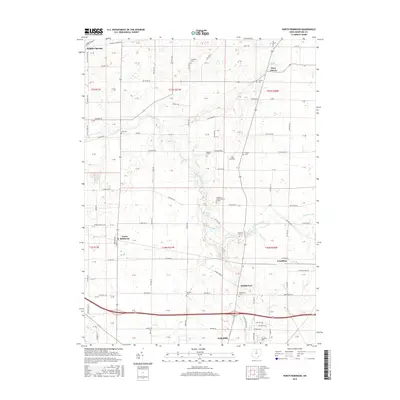
2016 Map of North Robinson
USGS Topo · Published 2016About this map
The Sandusky River winds southward through this rural Crawford County landscape, where small agricultural settlements and historic cemeteries define the community layout. In the late 2010s, the village of North Robinson serves as a local hub near the intersection of Lincoln Hwy and the railroad corridors. The map details a high density of burial grounds, such as Sandusky Cem, Windfall Cem, and Leesville Cem, which are invaluable for genealogists tracing family histories in the region. To the south, the terrain descends toward the municipal boundary of Galion, while the eastern edge includes the outskirts of Crestline. Water features like Lake Galion and Pabst Lake provide local landmarks amidst the rectilinear grid of township roads. Transportation history is evident in the path of the historic Lincoln Hwy, which cuts across the central portion of the sheet, connecting these rural outposts.
Find a feature on this map
119 named features on this map. Tap any name to fly to it.
Don’t see what you’re looking for? This feature index may not catch every label — zoom into the map to look around manually.
Map Details
Editions of this 2016 North Robinson Map
This is the sole edition of this map. No revisions or reprints were ever made.
Other maps of this area

1913 · Mount Gilead
USGS Topo · 1:62,500

1915 · Bucyrus
USGS Topo · 1:62,500

1915 · Crestline
USGS Topo · 1:62,500

1915 · Shauck
USGS Topo · 1:62,500

1916 · Mount Gilead
USGS Topo · 1:62,500

1943 · Shauck
USGS Topo · 1:62,500

1943 · Bucyrus
USGS Topo · 1:62,500

1943 · Crestline
USGS Topo · 1:62,500

1943 · Mount Gilead
USGS Topo · 1:62,500

1950 · Marion
USGS Topo · 1:250,000