2023 Map of North Robinson
USGS Topo · Published 2023About this map
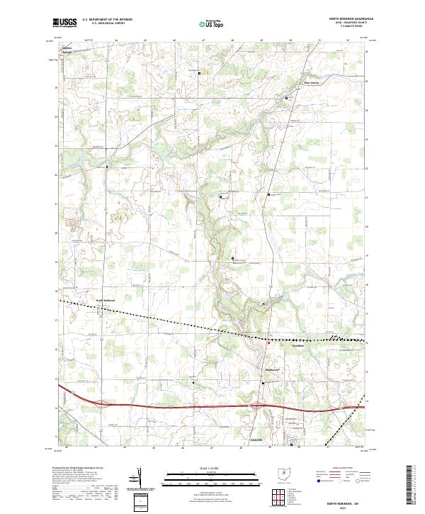
The upper reaches of the Sandusky River wind through this part of Crawford County, defining a landscape marked by small agricultural settlements and a network of township roads. North Robinson sits centrally near the intersection of Stetzer Rd and Beck Rd, while the larger municipal boundaries of Galion and Crestline occupy the southern and eastern margins. The map reveals a dense distribution of rural burial grounds such as Luke Cem, Biddle Cem, and Leesville Cem, which provide essential geographic anchors for genealogical research in this region.
Find a feature on this map
76 named features on this map. Tap any name to fly to it.
Don’t see what you’re looking for? This feature index may not catch every label — zoom into the map to look around manually.
Map Details
Editions of this 2023 North Robinson Map
This is the sole edition of this map. No revisions or reprints were ever made.