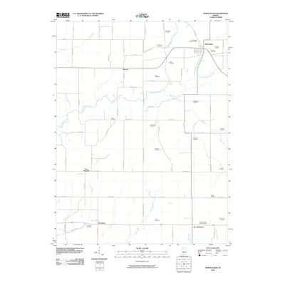
2010 Map of North Salem
USGS Topo · Published 2010About this map
North Salem serves as the primary hub of this rural landscape, situated at the junction of local roads and the headwaters of the Middle Fork Big Walnut Creek. The area is defined by its extensive collection of family and community burial grounds, which offer significant genealogical value for researchers of Central Indiana. From the Richardson Cemetery in the north to the Turner Farm Cemetery in the southeast, these sites represent the legacy of early farming families.
Find a feature on this map
49 named features on this map. Tap any name to fly to it.
Don’t see what you’re looking for? This feature index may not catch every label — zoom into the map to look around manually.
Map Details
Editions of this 2010 North Salem Map
This is the sole edition of this map. No revisions or reprints were ever made.
Other maps of this area

1953 · Clayton
USGS Topo · 1:24,000

1953 · Lizton
USGS Topo · 1:24,000

1953 · Danville
USGS Topo · 1:24,000

1953 · Indianapolis
USGS Topo · 1:250,000

1956 · Indianapolis
USGS Topo · 1:250,000

1957 · Indianapolis
USGS Topo · 1:250,000

1957 · New Ross
USGS Topo · 1:24,000

1958 · Roachdale
USGS Topo · 1:24,000

1958 · Ladoga
USGS Topo · 1:24,000

1958 · Coatesville
USGS Topo · 1:24,000