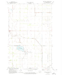
1972 Map of North Salt Lake
USGS Topo · Published 1974About this map
North Salt Lake and its surrounding wetlands anchor this prairie landscape in the early 1970s. The map illustrates a highly managed agricultural environment, defined by the County Ditch No 67A and County Ditch No 13 systems that redirect water across the flat terrain of Midland and Martin townships. Environmental preservation efforts are evident in the North Salt Lake State Game Management Area, which borders the lake's southern edge. Transportation and infrastructure follow the section lines of the Red River Valley, with the Burlington Northern railroad running along the eastern boundary. This survey was produced through a collaboration between the USGS and the State of North Dakota Water Commission, reflecting the era's focus on hydrology and land drainage in the border region between Pembina and Walsh counties.
Find a feature on this map
13 named features on this map. Tap any name to fly to it.
Don’t see what you’re looking for? This feature index may not catch every label — zoom into the map to look around manually.
Map Details
Editions of this 1972 North Salt Lake Map
This is the sole edition of this map. No revisions or reprints were ever made.
Other maps of this area

1918 · Acton
USGS Topo · 1:62,500

1939 · Drayton
USGS Topo · 1:62,500

1939 · Glasston
USGS Topo · 1:62,500

1941 · Drayton
USGS Topo · 1:62,500

1941 · Glasston
USGS Topo · 1:62,500

1943 · Grafton
USGS Topo · 1:62,500

1952 · Thief River Falls
USGS Topo · 1:250,000

1956 · Thief River Falls
USGS Topo · 1:250,000

1957 · Thief River Falls
USGS Topo · 1:250,000

1960 · Grafton
USGS Topo · 1:24,000