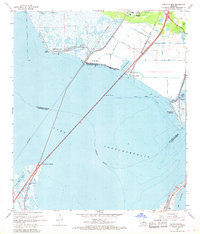
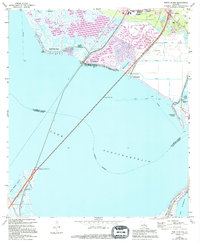
1967 Map of North Shore
USGS Topo · Published 1968About this map
Lake Pontchartrain dominates this mid-century view, bisected by the long rail trestle of the Southern line extending from Pointe aux Herbes toward the northern shoreline. The map documents the intricate coastal geography of the St Tammany Parish Orleans Parish border before modern expansion altered the waterfront. Near the southern terminus of the rail bridge, the St Pike Chapel stands near the marshy shores of Lake St Catherine, while to the north, the growing community of Slidell begins to expand toward the coast. A network of drainage canals, including Canal No 1 and Canal No 4, illustrates the early efforts to manage the wetlands for development near North Shore Beach and Howze Beach. Local landmarks like the Fields Cem and North Shore Chapel provide essential touchpoints for genealogists researching family ties to these coastal settlements.
Find a feature on this map
33 named features on this map. Tap any name to fly to it.
Don’t see what you’re looking for? This feature index may not catch every label — zoom into the map to look around manually.
Map Details
Editions of this 1967 North Shore Map
5 editions found
Other maps of this area

1892 · Chef Menteur
USGS Topo · 1:62,500

1893 · Rigolets
USGS Topo · 1:62,500

1914 · Nicholson
USGS Topo · 1:62,500

1921 · Nicholson
USGS Topo · 1:62,500

1935 · Slidell
USGS Topo · 1:62,500

1936 · North Shore
USGS Topo · 1:31,680

1936 · South Point
USGS Topo · 1:31,680

1936 · Chef Menteur
USGS Topo · 1:62,500

1936 · Rigolets
USGS Topo · 1:62,500

1937 · Chef Menteur
USGS Topo · 1:31,680