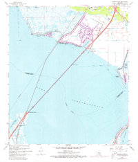
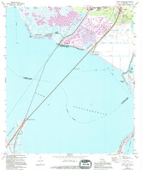
1967 Map of North Shore
USGS Topo · Published 1973About this map
Lake Pontchartrain dominates this coastal landscape, showing the transition from the marshy edges of St. Tammany Parish to the water. The northern shoreline is characterized by mid-century development and water management, evidenced by the intricate system of residential waterways including Canal No 1 through Canal No 8. The map documents the engineering of the era, where the Southern railroad and highway infrastructure span the open water toward the St Tammany Parish Orleans Parish line.
Find a feature on this map
36 named features on this map. Tap any name to fly to it.
Don’t see what you’re looking for? This feature index may not catch every label — zoom into the map to look around manually.
Map Details
Editions of this 1967 North Shore Map
5 editions found
Other maps of this area

1892 · Chef Menteur
USGS Topo · 1:62,500

1893 · Rigolets
USGS Topo · 1:62,500

1914 · Nicholson
USGS Topo · 1:62,500

1921 · Nicholson
USGS Topo · 1:62,500

1935 · Slidell
USGS Topo · 1:62,500

1936 · North Shore
USGS Topo · 1:31,680

1936 · South Point
USGS Topo · 1:31,680

1936 · Chef Menteur
USGS Topo · 1:62,500

1936 · Rigolets
USGS Topo · 1:62,500

1937 · Chef Menteur
USGS Topo · 1:31,680