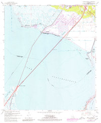
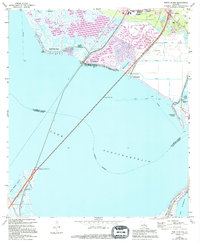
1967 Map of North Shore
USGS Topo · Published 1980About this map
Lake Pontchartrain dominates this coastal landscape, where the Southern railroad line and modern highway infrastructure bridge the water between St. Tammany and Orleans Parishes. The map reveals a complex network of residential and industrial waterways, including the development at Grand Lagoon and a series of numbered canals branching near Slidell. Along the shoreline, small settlements like North Shore Beach and Howze Beach sit near marshy points such as Big Point.
Find a feature on this map
35 named features on this map. Tap any name to fly to it.
Don’t see what you’re looking for? This feature index may not catch every label — zoom into the map to look around manually.
Map Details
Editions of this 1967 North Shore Map
5 editions found
Other maps of this area

1892 · Chef Menteur
USGS Topo · 1:62,500

1893 · Rigolets
USGS Topo · 1:62,500

1914 · Nicholson
USGS Topo · 1:62,500

1921 · Nicholson
USGS Topo · 1:62,500

1935 · Slidell
USGS Topo · 1:62,500

1936 · North Shore
USGS Topo · 1:31,680

1936 · South Point
USGS Topo · 1:31,680

1936 · Chef Menteur
USGS Topo · 1:62,500

1936 · Rigolets
USGS Topo · 1:62,500

1937 · Chef Menteur
USGS Topo · 1:31,680