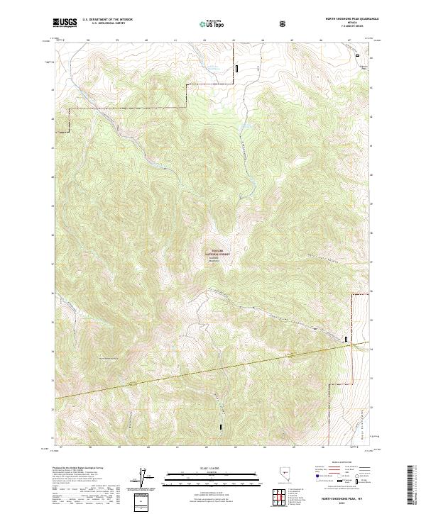
2021 Map of North Shoshone Peak
USGS Topo · Published 2021About this map
North Shoshone Peak towers over the central Shoshone Mountains in this 2021 survey of the high-desert terrain spanning the border of Lander and Nye Counties. The landscape is defined by its dramatic vertical relief, where steep drainage systems like Devils Gate Canyon and Underdown Canyon carve paths through the mountain range. Water sources are critical landmarks in this environment, represented by named sites such as Lower Cole Camp Spring and Upper Cole Camp Springs. The eastern edge of the map descends toward the Reese River Valley, while the western slopes feed into Peterson Creek and Schoonover Creek. Entirely contained within the Toiyabe National Forest, the area is primarily accessible via Forest Service roads like Ione Road and the 300A trail system, providing a detailed record of the ridgelines and canyons north of Becker Canyon.
Find a feature on this map
26 named features on this map. Tap any name to fly to it.
Don’t see what you’re looking for? This feature index may not catch every label — zoom into the map to look around manually.
Map Details
Editions of this 2021 North Shoshone Peak Map
This is the sole edition of this map. No revisions or reprints were ever made.
Other maps of this area

1955 · Millett
USGS Topo · 1:250,000

1956 · South Shoshone Peak
USGS Topo · 1:62,500

1956 · North Shoshone Peak
USGS Topo · 1:62,500

1959 · Millett
USGS Topo · 1:250,000

1969 · Dutch Flat
USGS Topo · 1:24,000

1969 · Iron Mountain
USGS Topo · 1:24,000
1969 · Carroll Summit SE
USGS Topo · 1:24,000

1985 · Smith Creek Valley
USGS Topo · 1:100,000
1988 · Tierney Creek
USGS Topo · 1:24,000
1988 · Gold Park
USGS Topo · 1:24,000