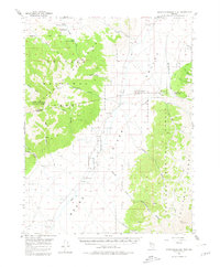
1956 Map of North Shoshone Peak
USGS Topo · Published 1980About this map
The Toiyabe Mountains and the Reese River Valley dominate this mid-century Nevada landscape, where the high peaks of the Toiyabe National Forest meet the drainage of the Reese River. This 1956 survey documents the remote character of Nye and Lander Counties, centered on the Yomba Indian Reservation along the river's path. High-altitude points like North Shoshone Peak and French mark the ridgelines, while numerous canyons including Devils Gate Canyon and Underdown Canyon cut through the range toward the valley floor. Signs of human activity are sparse but specific, including the O'Toole Ranch, the Marysville Trail, and several unnamed prospects and a shaft that suggest the region's mining interest. The reliance on natural water sources is evident through named features like Upper Cole Camp Springs and Lower Cole Camp Spring, essential for ranching and travel in this arid interior.
Find a feature on this map
48 named features on this map. Tap any name to fly to it.
Don’t see what you’re looking for? This feature index may not catch every label — zoom into the map to look around manually.
Map Details
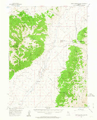
Editions of this 1956 North Shoshone Peak Map
3 editions found
Other maps of this area

1907 · Tonopah
USGS Topo · 1:250,000

1908 · Tonopah
USGS Topo · 1:250,000

1948 · Ione
USGS Topo · 1:62,500

1950 · Ione
USGS Topo · 1:62,500

1955 · Millett
USGS Topo · 1:250,000

1956 · South Shoshone Peak
USGS Topo · 1:62,500

1956 · North Shoshone Peak
USGS Topo · 1:62,500

1956 · Millett Ranch
USGS Topo · 1:62,500

1956 · Austin
USGS Topo · 1:62,500

1956 · Tonopah
USGS Topo · 1:250,000