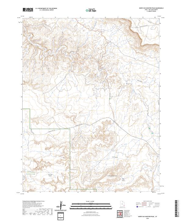
2023 Map of North Six-shooter Peak
USGS Topo · Published 2023About this map
North Sixshooter Peak and the high desert plateau of Hatch Point dominate this landscape within San Juan County. This survey illustrates a complex network of primitive roads and drainage systems, including the headwaters of Indian Creek and Salt Creek. The western portion of the map covers the eastern boundary of Canyonlands National Park, showing the transition from public range land to protected wilderness. Human activity is evidenced by isolated points of interest like the Needles Outpost and several distinct geological depressions known as pockets, including Corral Pocket and Bogus Pocket. Navigational routes such as the Falls Missile Trl and Lockhart Road Trl crisscross the terrain, reflecting the era's reliance on 4WD trails to access these remote mesas and draws like Harts Draw.
Find a feature on this map
20 named features on this map. Tap any name to fly to it.
Don’t see what you’re looking for? This feature index may not catch every label — zoom into the map to look around manually.
Map Details
Editions of this 2023 North Six-shooter Peak Map
This is the sole edition of this map. No revisions or reprints were ever made.
Other maps of this area

1885 · La Sal
USGS Topo · 1:250,000

1951 · Upheaval Dome
USGS Topo · 1:62,500

1952 · Carlisle 2 SE
USGS Topo · 1:24,000

1953 · The Needles
USGS Topo · 1:62,500

1954 · Carlisle 4 SW
USGS Topo · 1:24,000

1954 · Carlisle 4 NW
USGS Topo · 1:24,000
1954 · Carlisle 4 SE
USGS Topo · 1:24,000

1954 · Carlisle 1 SE
USGS Topo · 1:24,000

1954 · Carlisle 4 NE
USGS Topo · 1:24,000

1954 · Carlisle 1 SW
USGS Topo · 1:24,000