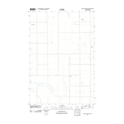
2011 Map of North Star Butte
USGS Topo · Published 2011About this map
Thirtymile Creek winds through the southern reaches of this landscape in Grant County, defining the drainage patterns of an otherwise high prairie terrain. The topography is anchored by two prominent rises, North Star Butte in the northwest and Antelope Butte to the northeast, which served as natural landmarks for early travelers and homesteaders. This 2011 survey reveals a strictly organized section-line road network, including routes like 77th Ave SW and 69th St SW, which trace the grid of agricultural development. Significant for family historians, the area preserves two distinct burial sites: Philadelphia Cemetery in the east and Ebenezer Cemetery centrally located, reflecting the community's early rural settlement and church history in this portion of the North Dakota plains.
Find a feature on this map
11 named features on this map. Tap any name to fly to it.
Don’t see what you’re looking for? This feature index may not catch every label — zoom into the map to look around manually.
Map Details
Editions of this 2011 North Star Butte Map
This is the sole edition of this map. No revisions or reprints were ever made.
Other maps of this area

1938 · Heart Butte
USGS Topo · 1:48,000

1944 · Heart Butte
USGS Topo · 1:62,500

1953 · Dickinson
USGS Topo · 1:250,000

1954 · Bismarck
USGS Topo · 1:250,000

1957 · Dickinson
USGS Topo · 1:250,000

1958 · Bismarck
USGS Topo · 1:250,000

1960 · Clark Butte SW
USGS Topo · 1:24,000

1960 · Clark Butte
USGS Topo · 1:24,000

1969 · Burt
USGS Topo · 1:24,000

1969 · North Star Butte
USGS Topo · 1:24,000