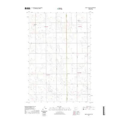
2020 Map of North Star Butte
USGS Topo · Published 2020About this map
North Star Butte and Antelope Butte dominate the landscape of this high plains region, where the terrain transitions across the boundary between Hettinger and Grant counties. The area is defined by a sparse, grid-based network of section lines and gravel roads, including 78th Ave SW and 77th Ave SW. This layout reflects the enduring influence of the Public Land Survey System on the North Dakota prairie, where life and travel are organized around mile-square sections. The drainage of Thirtymile Creek winds through the southern portion of the quadrangle, carving subtle valleys into the otherwise elevated plains. Cultural landmarks are limited to the rural Philadelphia Cemetery and Ebenezer Cemetery, which serve as primary markers of the early families who settled these townships.
Find a feature on this map
19 named features on this map. Tap any name to fly to it.
Don’t see what you’re looking for? This feature index may not catch every label — zoom into the map to look around manually.
Map Details
Editions of this 2020 North Star Butte Map
This is the sole edition of this map. No revisions or reprints were ever made.
Other maps of this area

1938 · Heart Butte
USGS Topo · 1:48,000

1944 · Heart Butte
USGS Topo · 1:62,500

1953 · Dickinson
USGS Topo · 1:250,000

1954 · Bismarck
USGS Topo · 1:250,000

1957 · Dickinson
USGS Topo · 1:250,000

1958 · Bismarck
USGS Topo · 1:250,000

1960 · Clark Butte SW
USGS Topo · 1:24,000

1960 · Clark Butte
USGS Topo · 1:24,000

1969 · Burt
USGS Topo · 1:24,000

1969 · North Star Butte
USGS Topo · 1:24,000