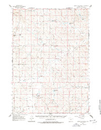
1959 Map of North Star School
USGS Topo · Published 1978About this map
Family-run livestock operations define the landscape of eastern Campbell County, where the Belle Fourche River winds through the high plains. The social and educational hub for these dispersed homesteads is the centrally located North Star School, situated among a network of prominent ranches including the EMS Ranch, Lee Wright Ranch, and Ohman Ranch. These operations are supported by a complex system of water management features, such as the Threemile Creek Res and Little Wild Horse Res, which were critical for sustaining herds in this semi-arid environment. The topography is marked by distinctive landforms like the Wild Horse Slope and Black Butte, while the drainage patterns of Pearson Draw and Rocky Gulch dictate the placement of ranch houses and several Landing Area strips. This survey captures the rural ranching culture of Wyoming before the large-scale energy development of later decades.
Find a feature on this map
36 named features on this map. Tap any name to fly to it.
Don’t see what you’re looking for? This feature index may not catch every label — zoom into the map to look around manually.
Map Details
Editions of this 1959 North Star School Map
2 editions found
Other maps of this area

1953 · Savageton
USGS Topo · 1:24,000

1953 · South Butte
USGS Topo · 1:24,000

1954 · Gillette
USGS Topo · 1:250,000

1955 · Newcastle
USGS Topo · 1:250,000

1955 · Gillette
USGS Topo · 1:250,000

1958 · Gillette
USGS Topo · 1:250,000

1958 · Newcastle
USGS Topo · 1:250,000

1959 · Savageton
USGS Topo · 1:62,500

1959 · North Star School
USGS Topo · 1:62,500

1960 · Turnercrest
USGS Topo · 1:62,500