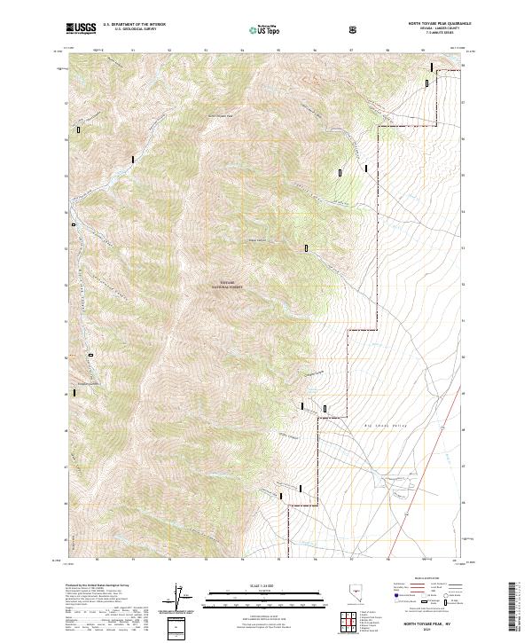
2021 Map of North Toiyabe Peak
USGS Topo · Published 2021About this map
North Toiyabe Peak dominates this high-altitude landscape within the Toiyabe National Forest, where steep drainages like Cahills Cañon and Big Creek Canyon carve the mountain flanks. The terrain drops sharply into the Big Smoky Valley to the east, revealing a transition from mountain wilderness to the valley floor. The map records several high-elevation points of interest, including the prominent Bunker Hill and Kingston Summit. Human presence is concentrated near the valley margin, where the Smokey Valley School and Gillman Spring are located. An intricate network of recreational and access routes, such as the Lynch Creek Loop and Tar Creek Loop, provides access to the higher ridges, while the Spanish Canyon Trl offers a historical path through the canyons of Lander County.
Find a feature on this map
46 named features on this map. Tap any name to fly to it.
Don’t see what you’re looking for? This feature index may not catch every label — zoom into the map to look around manually.
Map Details
Editions of this 2021 North Toiyabe Peak Map
This is the sole edition of this map. No revisions or reprints were ever made.
Other maps of this area

1926 · Roberts Mountains
USGS Topo · 1:250,000

1929 · Roberts Mountains
USGS Topo · 1:250,000

1955 · Millett
USGS Topo · 1:250,000

1956 · Millett Ranch
USGS Topo · 1:62,500

1956 · Austin
USGS Topo · 1:62,500

1959 · Millett
USGS Topo · 1:250,000

1960 · Spencer Hot Springs
USGS Topo · 1:62,500

1960 · Wildcat Peak
USGS Topo · 1:62,500

1978 · Summit Mountain
USGS Topo · 1:100,000

1985 · Smith Creek Valley
USGS Topo · 1:100,000