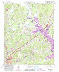
1973 Map of Northeast Durham
USGS Topo · Published 1992About this map
The confluence of the Little River, Flat River, and Eno River creates the headwaters of the Neuse River at the core of this North Carolina quadrangle. This 1973 survey, updated with 1987 photo-revisions, documents the landscape during the creation of Falls Lake and the Falls Lake State Park. As the reservoir transformed the river valley, the surrounding uplands remained dotted with rural institutions and family-named settlements. On the outskirts of Durham, researchers can find the Merrick-Moore Sch and Oak Grove Memorial Gardens. The northern reaches of the map show the rural character near Butner and Cozart, where the Southern railroad line cuts through the terrain. The presence of the Durham Skypark Airport and various local congregations like Fletcher Chapel and Union Chapel illustrate the community development between the growing city and the new state park.
Find a feature on this map
44 named features on this map. Tap any name to fly to it.
Don’t see what you’re looking for? This feature index may not catch every label — zoom into the map to look around manually.
Map Details
Editions of this 1973 Northeast Durham Map
4 editions found
Other maps of this area

1943 · Durham South
USGS Topo · 1:62,500

1943 · Raleigh
USGS Topo · 1:62,500

1943 · Creedmoor
USGS Topo · 1:62,500

1944 · Creedmoor
USGS Topo · 1:62,500

1951 · Raleigh
USGS Topo · 1:62,500

1951 · Durham South
USGS Topo · 1:62,500

1951 · Durham North
USGS Topo · 1:62,500

1953 · Raleigh
USGS Topo · 1:250,000

1953 · Greensboro
USGS Topo · 1:250,000

1954 · Greensboro
USGS Topo · 1:250,000