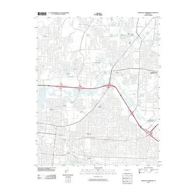
2010 Map of Northeast Memphis
USGS Topo · Published 2010About this map
The Wolf River snakes through the center of this northeastern Memphis landscape, defining a corridor of wooded riparian terrain amidst a dense network of suburban and industrial development. Extensive rail infrastructure is prominent here, notably the large Hollywood Yards and Leewood Yards that serve the city's logistical needs. Several legacy post offices, including Highland Heights and Binghamton, mark the established neighborhoods that border the city center.
Find a feature on this map
60 named features on this map. Tap any name to fly to it.
Don’t see what you’re looking for? This feature index may not catch every label — zoom into the map to look around manually.
Map Details
Editions of this 2010 Northeast Memphis Map
This is the sole edition of this map. No revisions or reprints were ever made.
Other maps of this area

1916 · Memphis
USGS Topo · 1:62,500

1925 · Memphis
USGS Topo · 1:48,000

1927 · Memphis
USGS Topo · 1:62,500

1931 · Jericho
USGS Topo · 1:62,500

1939 · Jericho
USGS Topo · 1:62,500

1939 · Memphis
USGS Topo · 1:62,500

1942 · Millington
USGS Topo · 1:62,500

1952 · Jericho
USGS Topo · 1:62,500

1953 · Memphis
USGS Topo · 1:250,000

1955 · Memphis
USGS Topo · 1:62,500