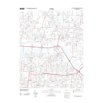
2013 Map of Northeast Memphis
USGS Topo · Published 2013About this map
The Wolf River winds through this urban and suburban landscape, serving as a natural divider between the industrial rail corridors and the established residential neighborhoods of northeast Memphis. Significant logistics infrastructure is evident at Hollywood Yards and Leewood Yards, highlighting the area's role as a transportation hub. The map captures the distinct character of varied communities, from the planned layout of Chickasaw Gardens and Hedgemoor to the older centers of Raleigh and Binghampton.
Find a feature on this map
44 named features on this map. Tap any name to fly to it.
Don’t see what you’re looking for? This feature index may not catch every label — zoom into the map to look around manually.
Map Details
Editions of this 2013 Northeast Memphis Map
This is the sole edition of this map. No revisions or reprints were ever made.
Other maps of this area

1916 · Memphis
USGS Topo · 1:62,500

1925 · Memphis
USGS Topo · 1:48,000

1927 · Memphis
USGS Topo · 1:62,500

1931 · Jericho
USGS Topo · 1:62,500

1939 · Jericho
USGS Topo · 1:62,500

1939 · Memphis
USGS Topo · 1:62,500

1942 · Millington
USGS Topo · 1:62,500

1952 · Jericho
USGS Topo · 1:62,500

1953 · Memphis
USGS Topo · 1:250,000

1955 · Memphis
USGS Topo · 1:62,500