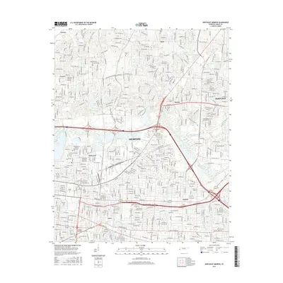
2016 Map of Northeast Memphis
USGS Topo · Published 2016About this map
The Wolf River winds through the heart of this northeast section of Memphis, defining the transition between the urban core and the established suburbs of Raleigh, Berclair, and Bartlett. This modern survey reveals a landscape deeply rooted in education and local history, featuring prominent institutions such as Rhodes Coll, Christian Brothers Univ, and the Memphis Theological Seminary. The settlement patterns here are dense, with the historic neighborhoods of Hollywood and Aulon clustered near the rail lines and major thoroughfares.
Find a feature on this map
88 named features on this map. Tap any name to fly to it.
Don’t see what you’re looking for? This feature index may not catch every label — zoom into the map to look around manually.
Map Details
Editions of this 2016 Northeast Memphis Map
This is the sole edition of this map. No revisions or reprints were ever made.
Other maps of this area

1916 · Memphis
USGS Topo · 1:62,500

1925 · Memphis
USGS Topo · 1:48,000

1927 · Memphis
USGS Topo · 1:62,500

1931 · Jericho
USGS Topo · 1:62,500

1939 · Jericho
USGS Topo · 1:62,500

1939 · Memphis
USGS Topo · 1:62,500

1942 · Millington
USGS Topo · 1:62,500

1952 · Jericho
USGS Topo · 1:62,500

1953 · Memphis
USGS Topo · 1:250,000

1955 · Memphis
USGS Topo · 1:62,500