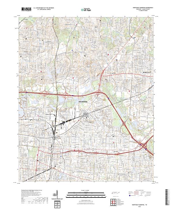
2022 Map of Northeast Memphis
USGS Topo · Published 2022About this map
Memphis and its northeastern suburbs are anchored by a complex network of waterways and educational institutions in this 2022 topographical survey. The landscape is defined by the eastward progression from Hollywood and Aulon toward Berclair and Bartlett, with the Wolf River and Fletcher Creek cutting through the urban grid. The presence of Rhodes College, Christian Brothers University, and the Memphis Theological Seminary highlights the area's role as an intellectual hub, while historic markers like Raleigh Historic Cem and Egypt Cem preserve the lineage of earlier settlements like Egypt and Raleigh. Local history is embedded in the street names and family cemeteries, such as the Brooks Jackson Cem and Mullins Chapel Cem, which sit amidst modern corridors like Sam Cooper Blvd and Summer Ave. The map captures the dense residential and commercial expansion that has integrated these once-distinct communities into the larger metropolitan fabric.
Find a feature on this map
50 named features on this map. Tap any name to fly to it.
Don’t see what you’re looking for? This feature index may not catch every label — zoom into the map to look around manually.
Map Details
Editions of this 2022 Northeast Memphis Map
This is the sole edition of this map. No revisions or reprints were ever made.
Other maps of this area

1916 · Memphis
USGS Topo · 1:62,500

1925 · Memphis
USGS Topo · 1:48,000

1927 · Memphis
USGS Topo · 1:62,500

1931 · Jericho
USGS Topo · 1:62,500

1939 · Jericho
USGS Topo · 1:62,500

1939 · Memphis
USGS Topo · 1:62,500

1942 · Millington
USGS Topo · 1:62,500

1952 · Jericho
USGS Topo · 1:62,500

1953 · Memphis
USGS Topo · 1:250,000

1955 · Memphis
USGS Topo · 1:62,500