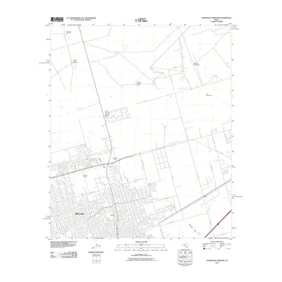
2010 Map of Northeast Midland
USGS Topo · Published 2010About this map
The city of Midland expands across this West Texas landscape, showing a late-career transition from open ranching country to urban infrastructure. The southern and western portions of the map are defined by dense residential and commercial street grids, with prominent civic spaces such as Fairview Cemetery and Rest Haven Cemetery marking the edge of town. To the north and east, the desert terrain remains largely undeveloped, dotted with cattle-ranching relics like Big Lake Windmill, China Grove Windmill, and Windmill Number Six.
Find a feature on this map
33 named features on this map. Tap any name to fly to it.
Don’t see what you’re looking for? This feature index may not catch every label — zoom into the map to look around manually.
Map Details
Editions of this 2010 Northeast Midland Map
This is the sole edition of this map. No revisions or reprints were ever made.
Other maps of this area

1954 · Hobbs
USGS Topo · 1:250,000

1954 · Pecos
USGS Topo · 1:250,000

1954 · Big Spring
USGS Topo · 1:250,000

1954 · San Angelo
USGS Topo · 1:250,000

1957 · Pecos
USGS Topo · 1:250,000

1958 · San Angelo
USGS Topo · 1:250,000

1958 · Big Spring
USGS Topo · 1:250,000

1958 · Hobbs
USGS Topo · 1:250,000

1965 · San Angelo
USGS Topo · 1:250,000

1965 · Southeast Midland
USGS Topo · 1:24,000