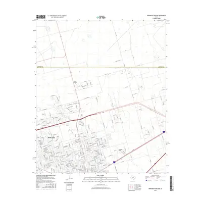
2016 Map of Northeast Midland
USGS Topo · Published 2016About this map
Midland expanded significantly into the Permian Basin's arid landscape by the mid-2010s, with this survey capturing the suburban and industrial grid pushing against the Martin County line. The northern reaches of the city are defined by aviation and transportation hubs, including the well-established Midland Airpark and the Ryan Aerodrome. Residential growth is mapped through a dense network of streets like Wadley Ave and Moss Ave, which contrast with the open terrain and natural drainage of Midland Draw. For local historians and genealogists, the map provides precise locations for Fairview Cemetery and Rest Haven Cemetery, alongside the Valhalla Mausoleum. The intersection of major corridors like Hwy 80 and W Loop 250 N illustrates the region's reliance on high-capacity transit to support its role as a regional energy and commerce center.
Find a feature on this map
125 named features on this map. Tap any name to fly to it.
Don’t see what you’re looking for? This feature index may not catch every label — zoom into the map to look around manually.
Map Details
Editions of this 2016 Northeast Midland Map
This is the sole edition of this map. No revisions or reprints were ever made.
Other maps of this area

1954 · Hobbs
USGS Topo · 1:250,000

1954 · Pecos
USGS Topo · 1:250,000

1954 · Big Spring
USGS Topo · 1:250,000

1954 · San Angelo
USGS Topo · 1:250,000

1957 · Pecos
USGS Topo · 1:250,000

1958 · San Angelo
USGS Topo · 1:250,000

1958 · Big Spring
USGS Topo · 1:250,000

1958 · Hobbs
USGS Topo · 1:250,000

1965 · San Angelo
USGS Topo · 1:250,000

1965 · Southeast Midland
USGS Topo · 1:24,000