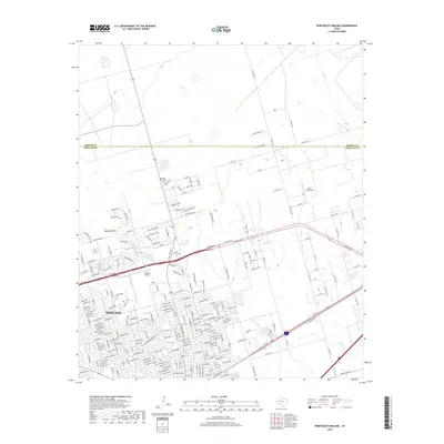
2019 Map of Northeast Midland
USGS Topo · Published 2019About this map
Midland expanded northward across this landscape in the late 2010s, its residential street grid reaching up toward the county line defined by Martin Co Midland Co. This map shows the suburban density of the city as it meets the open ranch lands of the Permian Basin. Two distinct aviation facilities, the Midland Airpark and the private Ryan Aerodrome, serve as significant landmarks along the northern edge of the development.
Find a feature on this map
27 named features on this map. Tap any name to fly to it.
Don’t see what you’re looking for? This feature index may not catch every label — zoom into the map to look around manually.
Map Details
Editions of this 2019 Northeast Midland Map
This is the sole edition of this map. No revisions or reprints were ever made.
Other maps of this area

1954 · Hobbs
USGS Topo · 1:250,000

1954 · Pecos
USGS Topo · 1:250,000

1954 · Big Spring
USGS Topo · 1:250,000

1954 · San Angelo
USGS Topo · 1:250,000

1957 · Pecos
USGS Topo · 1:250,000

1958 · San Angelo
USGS Topo · 1:250,000

1958 · Big Spring
USGS Topo · 1:250,000

1958 · Hobbs
USGS Topo · 1:250,000

1965 · San Angelo
USGS Topo · 1:250,000

1965 · Southeast Midland
USGS Topo · 1:24,000