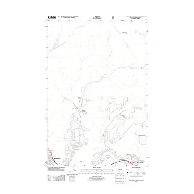
2011 Map of Northeast Missoula
USGS Topo · Published 2011About this map
Mount Jumbo and the northern outskirts of Missoula dominate this landscape during a period of modern expansion into the surrounding canyons and flats. The map documents the residential development of Pinegrove and West Riverside along the Clark Fork, where local connectivity is established via the Bandmann Bridge. The urban fringe of the city is clearly marked by landmarks such as the Orange Street Underpass and Waterworks Hill, while the Saint Mary Cemetery provides a focal point for genealogical interest at the town's edge.
Find a feature on this map
55 named features on this map. Tap any name to fly to it.
Don’t see what you’re looking for? This feature index may not catch every label — zoom into the map to look around manually.
Map Details
Editions of this 2011 Northeast Missoula Map
This is the sole edition of this map. No revisions or reprints were ever made.
Other maps of this area

1903 · Bonner
USGS Topo · 1:125,000

1912 · Missoula
USGS Topo · 1:125,000

1921 · Elbow Lake
USGS Topo · 1:125,000

1947 · Butte
USGS Topo · 1:250,000

1955 · Choteau
USGS Topo · 1:250,000

1956 · Wallace
USGS Topo · 1:250,000

1956 · Hamilton
USGS Topo · 1:250,000

1957 · Choteau
USGS Topo · 1:250,000

1958 · Butte
USGS Topo · 1:250,000

1958 · Choteau
USGS Topo · 1:250,000