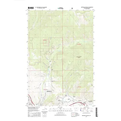
2017 Map of Northeast Missoula
USGS Topo · Published 2017About this map
Missoula and its northeastern expansion are defined by the convergence of steep canyon topography and the Clark Fork river valley in this 2017 survey. The transition from urban streets to wilderness is immediate, with the neighborhoods of East Missoula and West Riverside tucked along the river corridor below the prominent mass of Mt Jumbo. The northern half of the map is dominated by the Lolo National Forest, where labels like Wallman Trail and Rattlesnake Cr trace the recreational and watershed value of the Rattlesnake National Recreation Area.
Find a feature on this map
69 named features on this map. Tap any name to fly to it.
Don’t see what you’re looking for? This feature index may not catch every label — zoom into the map to look around manually.
Map Details
Editions of this 2017 Northeast Missoula Map
This is the sole edition of this map. No revisions or reprints were ever made.
Other maps of this area

1903 · Bonner
USGS Topo · 1:125,000

1912 · Missoula
USGS Topo · 1:125,000

1921 · Elbow Lake
USGS Topo · 1:125,000

1947 · Butte
USGS Topo · 1:250,000

1955 · Choteau
USGS Topo · 1:250,000

1956 · Wallace
USGS Topo · 1:250,000

1956 · Hamilton
USGS Topo · 1:250,000

1957 · Choteau
USGS Topo · 1:250,000

1958 · Butte
USGS Topo · 1:250,000

1958 · Choteau
USGS Topo · 1:250,000