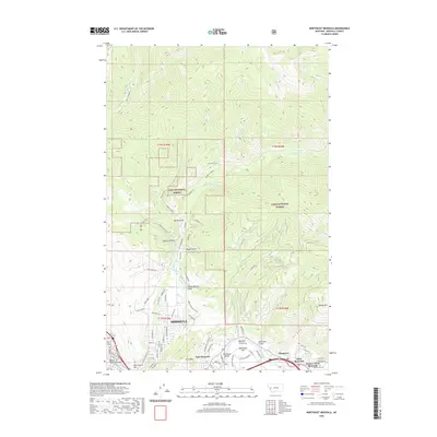
2020 Map of Northeast Missoula
USGS Topo · Published 2020About this map
The Clark Fork corridor and the rugged eastern flank of the Rattlesnake Mountains define this 2020 map of Missoula. Rising sharply from the valley floor, Mt Jumbo and Waterworks Hill overlook the growing communities of East Missoula and West Riverside. The landscape transitions from the urban density near the Orange Street Underpass and Saint Mary Cem to the protected expanse of the Lolo National Forest. This survey captures the modern interface of civilization and wilderness, where historical irrigation systems like the Williams Ditch and Quast Ditch once shaped the land. The complex topography is marked by numerous drainages, including Sawmill Gulch and Danny O'Brien Gulch, which connect the high peaks like Woody Mtn to the river valley. Transportation networks are prominent, featuring the Bandmann Bridge and a series of recreational paths such as the Wallman Trail and Rattlesnake Trl.
Find a feature on this map
53 named features on this map. Tap any name to fly to it.
Don’t see what you’re looking for? This feature index may not catch every label — zoom into the map to look around manually.
Map Details
Editions of this 2020 Northeast Missoula Map
This is the sole edition of this map. No revisions or reprints were ever made.
Other maps of this area

1903 · Bonner
USGS Topo · 1:125,000

1912 · Missoula
USGS Topo · 1:125,000

1921 · Elbow Lake
USGS Topo · 1:125,000

1947 · Butte
USGS Topo · 1:250,000

1955 · Choteau
USGS Topo · 1:250,000

1956 · Wallace
USGS Topo · 1:250,000

1956 · Hamilton
USGS Topo · 1:250,000

1957 · Choteau
USGS Topo · 1:250,000

1958 · Butte
USGS Topo · 1:250,000

1958 · Choteau
USGS Topo · 1:250,000