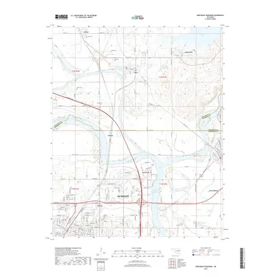
2018 Map of Northeast Muskogee
USGS Topo · Published 2018About this map
The confluence of three major waterways—the Verdigris River, Arkansas River, and Neosho River—dominates this landscape just northeast of Muskogee. This hydrographic nexus, long a focal point for Oklahoma navigation and trade, is marked by the presence of Fort Gibson and the modern expanse of Webbers Falls Reservoir. The map reveals a dense layering of local history through its numerous burial grounds, including Evergreen Cem, Cherokee Cem, Jamison Cem, and New Hope Cem, which are scattered among small communities like Okay, Wybark, and Gibson.
Find a feature on this map
52 named features on this map. Tap any name to fly to it.
Don’t see what you’re looking for? This feature index may not catch every label — zoom into the map to look around manually.
Map Details
Editions of this 2018 Northeast Muskogee Map
This is the sole edition of this map. No revisions or reprints were ever made.
Other maps of this area

1901 · Muscogee
USGS Topo · 1:125,000

1905 · Muscogee
USGS Topo · 1:125,000

1946 · Fort Smith
USGS Topo · 1:250,000

1948 · Hulbert
USGS Topo · 1:62,500

1948 · Keefeton
USGS Topo · 1:62,500

1948 · Webbers Falls
USGS Topo · 1:62,500

1948 · Wagoner
USGS Topo · 1:62,500

1950 · Keefeton
USGS Topo · 1:62,500

1950 · Wagoner
USGS Topo · 1:62,500

1950 · Hulbert
USGS Topo · 1:62,500