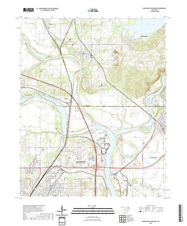
2022 Map of Northeast Muskogee
USGS Topo · Published 2022About this map
The Verdigris River, Arkansas River, and Neosho River converge in this river-rich corridor, shaping a landscape of fertile lowlands and strategic water management. The city of Muskogee dominates the southwestern quadrant, where Bacone College and the Indian Capital Technology Center - Muskogee highlight the area's educational infrastructure. To the north and east, the map reveals a network of smaller communities including Wybark, Okay, and Gibson, punctuated by family-named burial grounds such as Jamison Cem and Marshall Cem. The terrain transitions into the backwaters of Fort Gibson Lake and Webbers Falls Reservoir, while Anderson Bottoms and Hyde Park mark the natural floodplains. This survey captures the region's complex identity as a center for higher education, river navigation, and rural family settlements in the early twenty-first century.
Find a feature on this map
72 named features on this map. Tap any name to fly to it.
Don’t see what you’re looking for? This feature index may not catch every label — zoom into the map to look around manually.
Map Details
Editions of this 2022 Northeast Muskogee Map
This is the sole edition of this map. No revisions or reprints were ever made.
Other maps of this area

1901 · Muscogee
USGS Topo · 1:125,000

1905 · Muscogee
USGS Topo · 1:125,000

1946 · Fort Smith
USGS Topo · 1:250,000

1948 · Hulbert
USGS Topo · 1:62,500

1948 · Keefeton
USGS Topo · 1:62,500

1948 · Webbers Falls
USGS Topo · 1:62,500

1948 · Wagoner
USGS Topo · 1:62,500

1950 · Keefeton
USGS Topo · 1:62,500

1950 · Wagoner
USGS Topo · 1:62,500

1950 · Hulbert
USGS Topo · 1:62,500