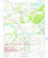
1974 Map of Northeast Muskogee
USGS Topo · Published 1978About this map
The confluence of the Arkansas River, Verdigris River, and Neosho River defines this industrial and educational hub in the mid-1970s. This territory is marked by the distinct boundary of the Shannon and Harris townships, where the Muskogee municipal area extends northward toward the Port of Muskogee. Significant local institutions are well-documented, including Bacone College, the State School for the Blind, and Muskogee High Sch. The map reveals a landscape heavily integrated with transportation infrastructure, from the Muskogee Turnpike to an extensive rail network featuring the Missouri - Kansas - Texas and St Louis - San Francisco lines. For genealogists, several burial grounds are preserved across the quadrangle, such as Green Hill Cemetery, Evergreen Cem, and the Marshall Cem near Tullahassee.
Find a feature on this map
67 named features on this map. Tap any name to fly to it.
Don’t see what you’re looking for? This feature index may not catch every label — zoom into the map to look around manually.
Map Details
Editions of this 1974 Northeast Muskogee Map
This is the sole edition of this map. No revisions or reprints were ever made.
Other maps of this area

1901 · Muscogee
USGS Topo · 1:125,000

1905 · Muscogee
USGS Topo · 1:125,000

1946 · Fort Smith
USGS Topo · 1:250,000

1948 · Hulbert
USGS Topo · 1:62,500

1948 · Keefeton
USGS Topo · 1:62,500

1948 · Webbers Falls
USGS Topo · 1:62,500

1948 · Wagoner
USGS Topo · 1:62,500

1950 · Keefeton
USGS Topo · 1:62,500

1950 · Wagoner
USGS Topo · 1:62,500

1950 · Hulbert
USGS Topo · 1:62,500